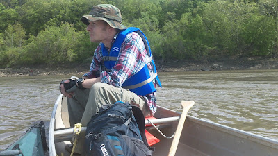
I was anxious to get back on the river since I hadn't been since last year right before it was closed for recreational use due to flooding. Back then the wing dikes were under about 15feet of water and Chuck and I were reaching speeds of almost 8mph while we were eating lunch just floating along. We made really good time but it wasn't a very good measure of actual river conditions. This time the wing dikes and buoys were in full view and we estimated the flow of the river to be around 3mph. I was kicking myself for forgetting my Garmin at home. The plan was to get some good metrics with which to plan our MR340 strategy. Next time I'll remember. I did manage to remember my spot tracker, but almost forgot to turn it on. A long time ago I realized that for me there is a limited amount of technology that I can bring on an adventure and use properly. The MR340 is really going to test my technological limitations (2cameras, gps, spot tracker, iphone, etc.) as well as my physical and mental toughness. I'm really looking forward to it.
 |
| Spot Tracker map |
 |
| Mark and Ryan in the little dingy. |
 |
| Nothing wrong with some river time. |
 |
| Bluffs, yo! |
 |
| Mark likes to chill. |
 |
| Ryan watching for any geese on the attack. |
 |
| Obligatory bridge picture. |
 |
| Watch out for the wing dikes! |
 |
| River view. |


You sure had a great day for it!
ReplyDeleteLooks like fun! Great pictures Patrick!
ReplyDelete